
Click on map for larger (printable) version.

Satellite Map

Drainage Map
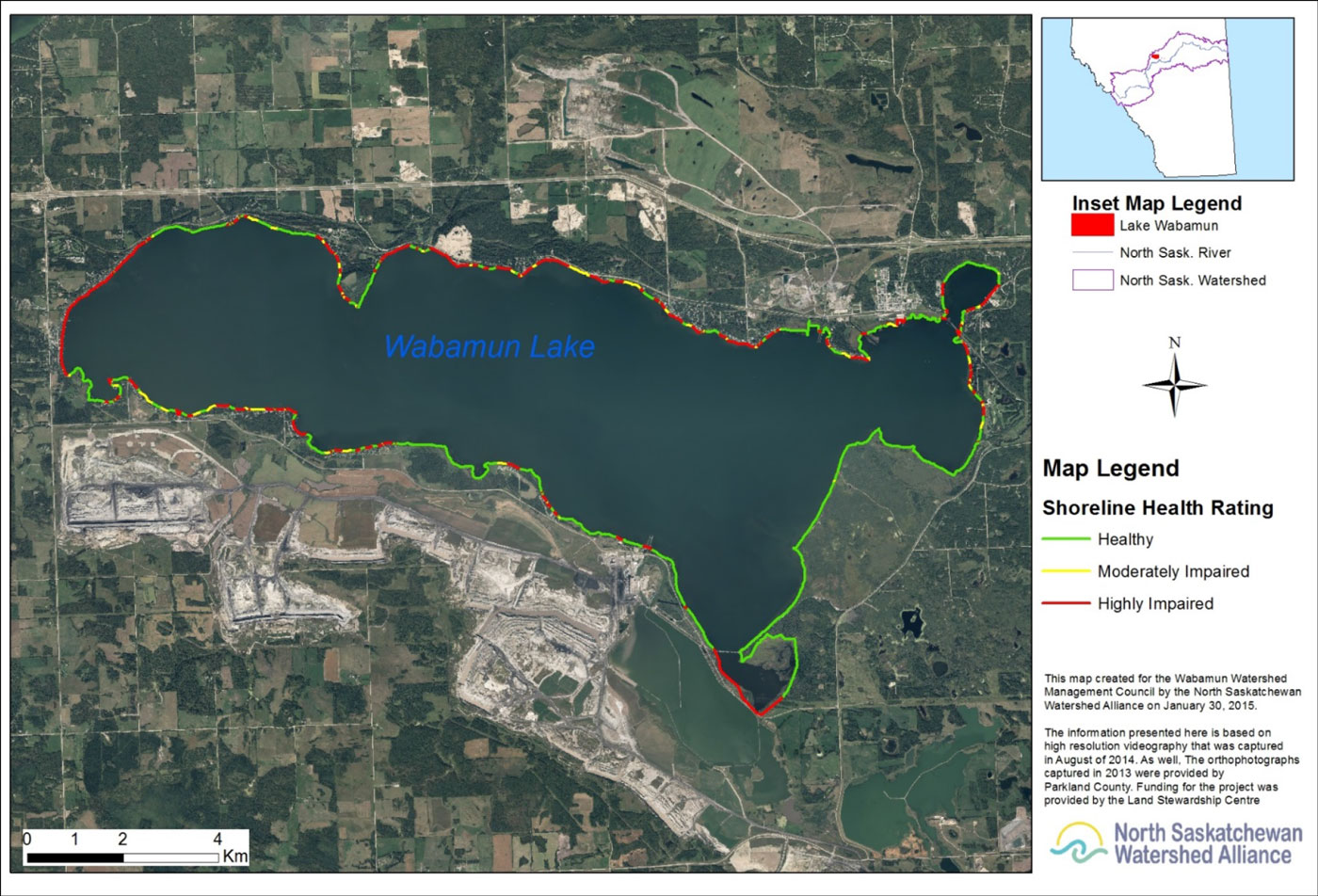
Aerial Ripiarian Health Assessment 2014
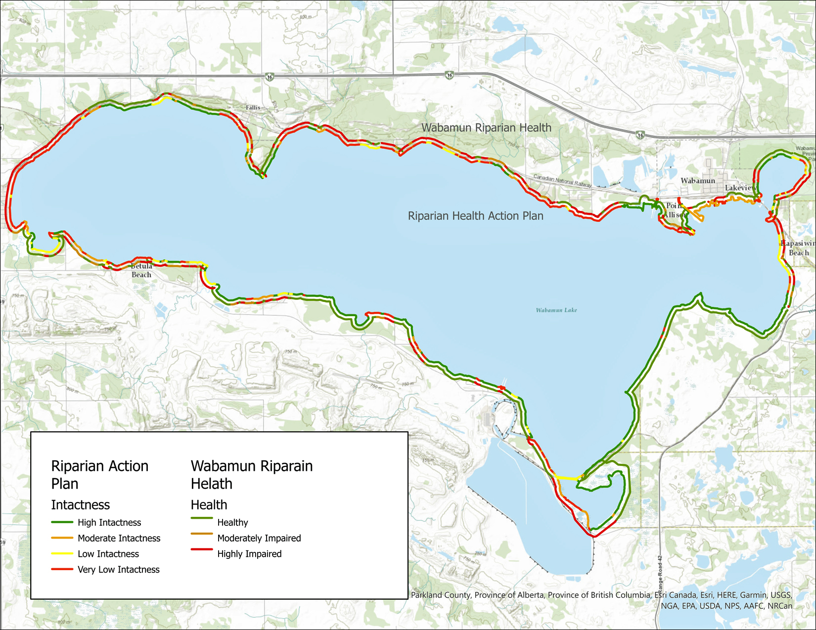
Map of Wabamun Lake showing the two different riparian assessment results as color-coded segments around the shoreline. The outermost line represents the 2014 Health of Wabamun Lake assessment, and the inner line represents the 2021 Riparian Health Action Plan assessment (both reports are available in the Studies & Reports page). Color meanings are provided within the legend.